
Luxembourg's Mullerthal region packs a lot into a small footprint, with sandstone gorges and sweeping plateaus surrounding sleepy river towns and diverse woodland. Earlier this summer, I walked the region’s namesake trail and captured its landscapes in my sketchbook along the way.
Matt traveled to Luxembourg in partnership with Visit Luxembourg. For a more detailed account of his adventure, check out his trip on Polarsteps. |
What is the Mullerthal Trail?
The Mullerthal Trail runs through eastern Luxembourg in three sections, totaling roughly 112km. Its triple-loop structure (with optional extensions) makes it easy to do in segments or string all three routes together, just like I did in August at the height of this summer’s heatwaves.
If you’re planning to visit the region and deciding which routes to discover, here’s what you can expect from each of the trail’s three sections.
Route 1: Open country and a plateau crossing

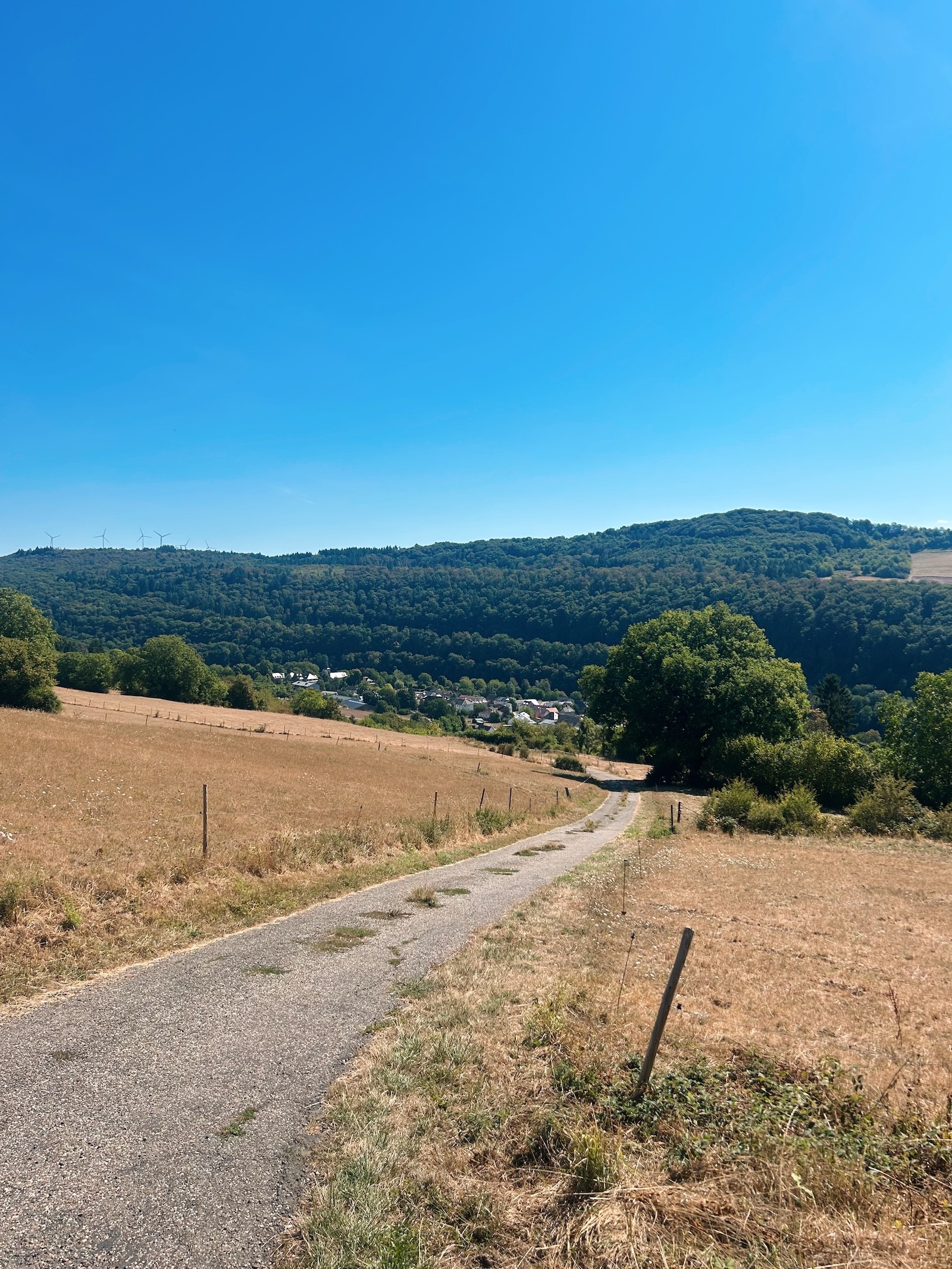
Route 1 is the most pastoral of the three sections. Moving clockwise from Echternach, the loop follows the River Sauer before climbing onto forested slopes, where sheer rock walls and sandstone pillars start to appear. Further along, the trail narrows through a few tight gullies before opening onto farmland near Rosport.
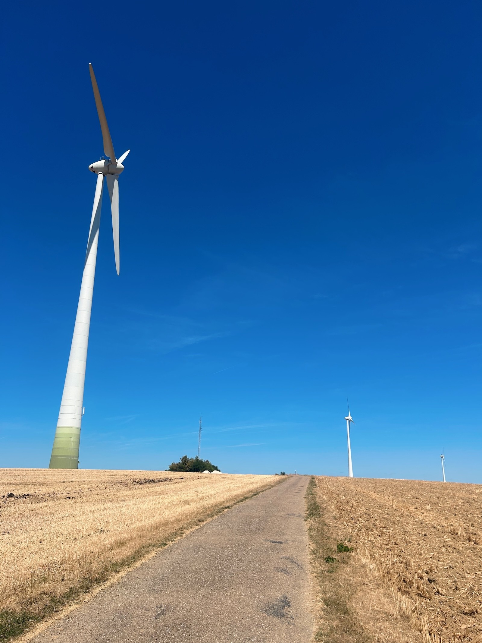
The standout stretch comes later, on the exposed plateau between Moersdorf and Herborn. A line of wind turbines sits close enough to the trail that you can hear the blades turning, and the surrounding fields turn a deep gold in summer. It's a shift in scenery from the forest sections and a good stretch for anyone who prefers open views to tree cover.
Route 1 is roughly 36km and is the quietest of the three loops, with long, undisturbed stretches ideal for entering the hiking headspace. Accommodations are limited in the small villages it passes through, but bus links to Moersdorf, Mompach, and Herborn make it easy to approach in sections.
 |  |  |  |
Route 2: The most dramatic scenery, and the busiest section
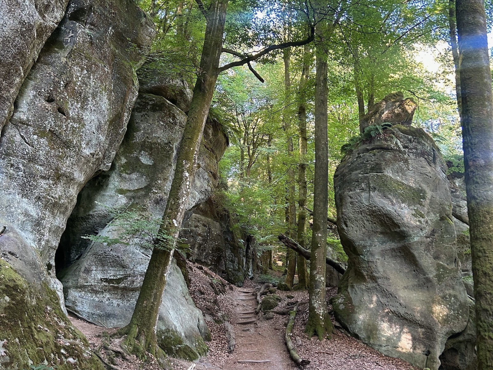
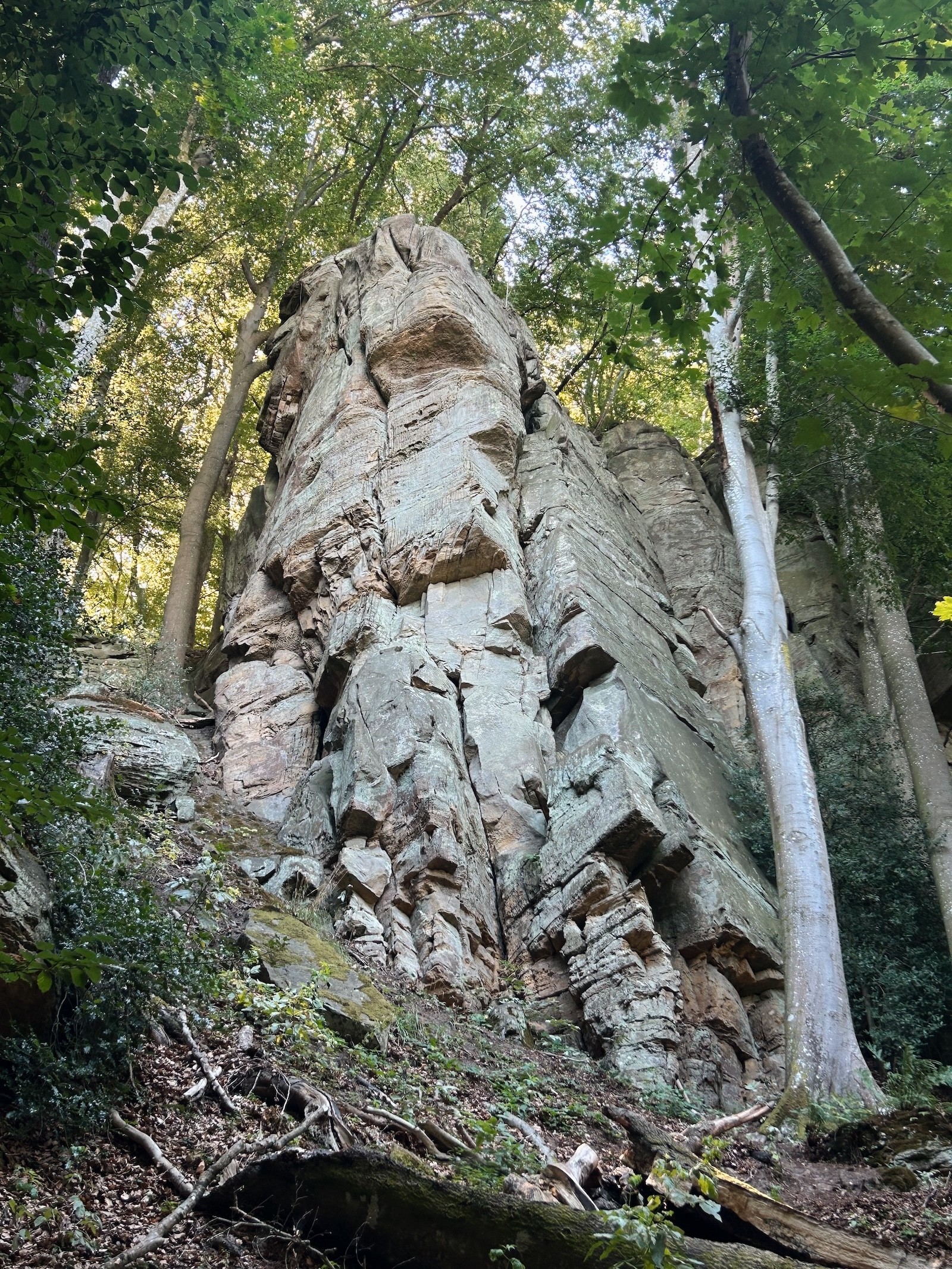
Route 2 passes the trail's best-known rock formations, including the Gorges du Loup and a cluster of pillars known locally as "The Labyrinth." Old millstone caves carved out over centuries appear along the way too.
This is the trail’s most heavily trafficked section, particularly around Berdorf and Mullerthal village, where paths can get congested. If you’re hoping for a quieter hike, consider starting early in the morning or later in the afternoon.
Past Mullerthal village, the crowds thin and the trail threads through a series of narrow crevices. The Rittergang and Déiwepëtz are just 30–50cm wide at their tightest points, and you’ll have to cross your fingers there’s nobody coming the other way while squeezing through Kuelscheier, which is 100 meters long. These crannies can be sidestepped if tight spaces aren’t for you, but if you do decide to pass through them, make sure to take off your backpack and have a flashlight handy.
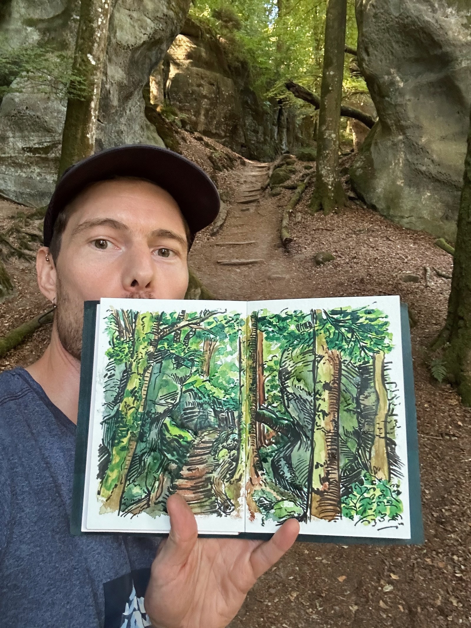
Route 2 is around 38km, which I split over two days to allow more time for sketching the most interesting parts of the trail. If starting your hike in Echternach, you can overnight in Consdorf to hike the whole loop in equal(ish) halves.
 |  |  |  |
Route 3: Forests, castles, and a return to open fields
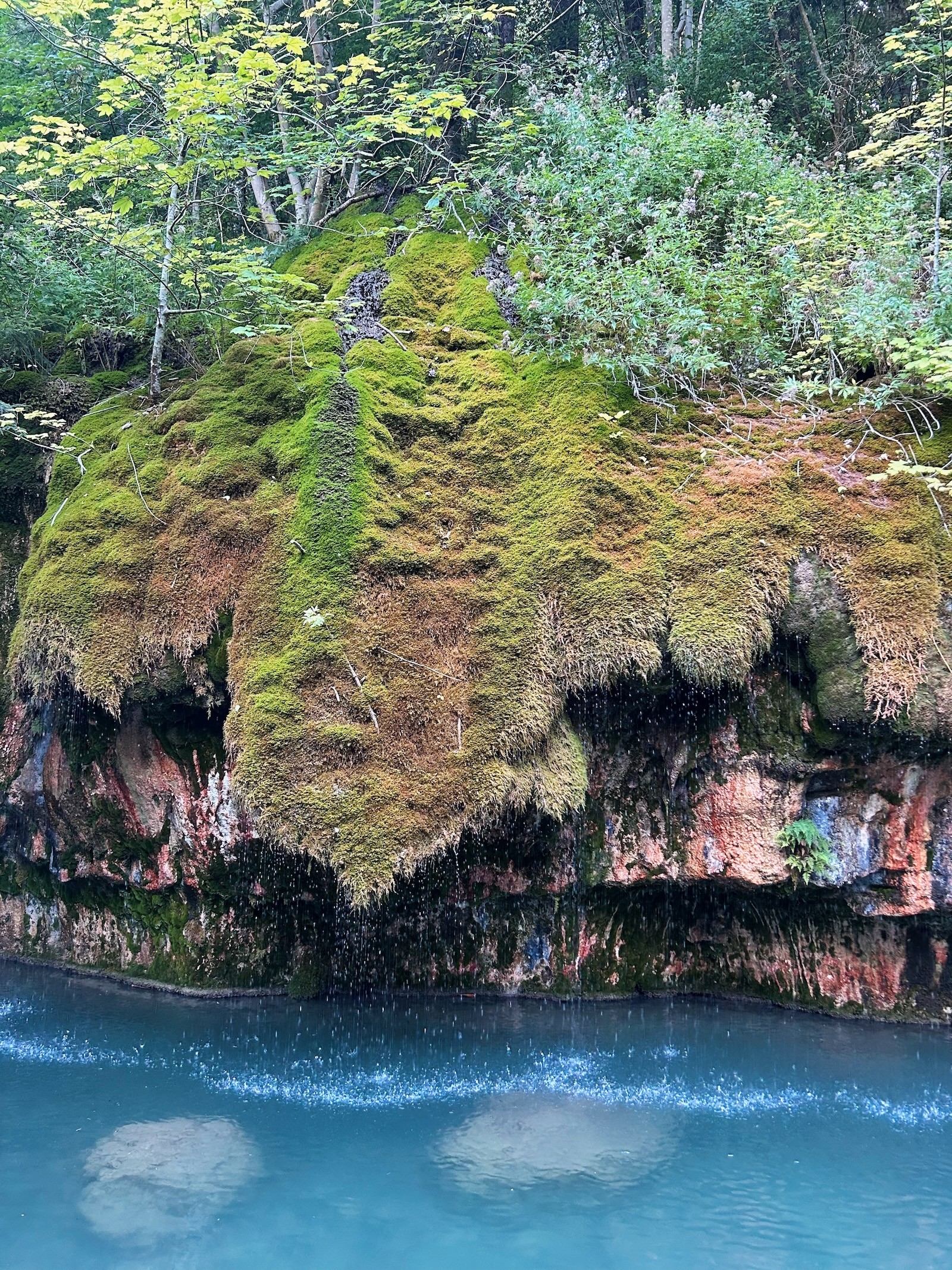
Route 3 shares some scenery with Route 2 as it passes through the sandstone gorges close to Mullerthal village. One of this route’s standout sights is the Kallektuff Spring, where water seeps through a curtain of spongy, jewel-tone moss before rhythmically tinkling into the turquoise pool below. What sets this route apart is the range of forests along the way. Slender pines poke up from tangled nettlebeds, dappled light filters through the canopies of densely packed beech trees, and broad-crowned walnut trees stand neatly along the driveways of rural homesteads. Best of all is the thick smell of jam as you hike beside the ditches full of ripening blackberries.
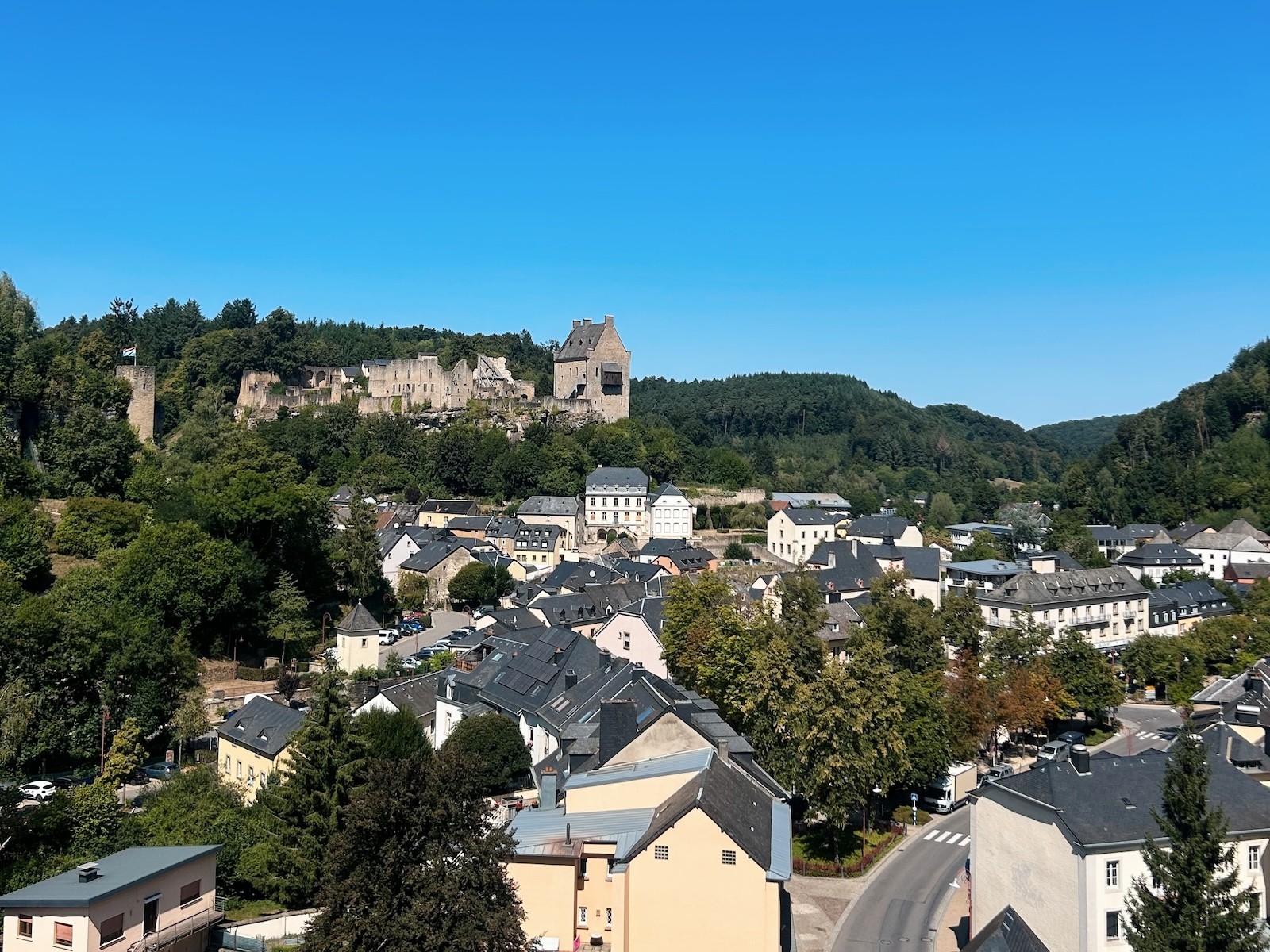
The second half of Route 3 flattens out into open fields and rolling farmland, and passes a pair of 11th-century castles in both Larochette and Beaufort.
At 38km, Route 3 is roughly the same length as the other two but features more varied terrain. Larochette offers an entry/exit point for splitting the route in half, with bus connections to Echternach and other nearby villages.
 |  |  |  |
My hiking itinerary

On day 1, I hiked the full Route 1 loop (39km with an accidental detour) and stayed overnight at Hôtel le Postillon in Echternach.
On day two, I hiked from Echternach to Scheidgen, covering around three-quarters of Route 2 (29km). My accommodation for the night was Hôtel Le Bon Repos.
On day three, I hiked the remaining 8km back to Echternach, then took the bus to Berdorf, where I stayed at the Trail-Inn.
On day four, I took the bus from Berdorf to pick up Route 3 around Mullerthal village, then hiked 32km to Beaufort before returning to Berdorf by bus.
Good to know while planning
All three routes run in a loop, so it's possible to stay in one base and day-hike each section.
Echternach is the region’s largest town and the best base, with the widest choice of accommodations, grocery stores, and restaurants.
Local buses link the villages on every route, making it easy to take on shorter sections or pick up where you left off without changing accommodation.
Public transport in Luxembourg is free, so you can shuttle between towns and trailheads at no extra cost.
Summer temperatures can climb well past 30°C, and some sections (mostly on routes 1 and 3) offer little to no shade.
Water and food stops are limited, so pack accordingly.
The Mullerthal Trail stays open year-round, but late spring to early autumn (May–Oct) is the best time to hike. Expect high humidity and crowds in summer (Jun–Aug), and take extra care on stone steps and wooden footbridges if visiting during winter (Dec–Feb).
Getting there
Luxembourg City is well connected by train and bus, and has its own airport with mostly European connections.
From Amsterdam, I took the train to Luxembourg City via Brussels, then caught the bus to Echternach (6–7 hours total).
On the way back, I returned to Amsterdam by train from Luxembourg City via Trier, Koblenz, and Düsseldorf (7–8 hours total).
As with most multi-leg train journeys, delays and tight connections are part of the deal, so building in some buffer time is always a good idea.
Check out Matt’s tracked trip on Polarsteps to read more about his hike and see more photos from the Mullerthal Trail, then plan your own adventure directly in the app. |
Tags
Outdoor
Europe
Slow travel
Solo travel
Travel planning